
First aerial maps produced by citizens featured on Google Earth and Google Maps
The Public Laboratory for Open Technology and Science, a 2011 Knight News Challenge winner, helps make technology work for communities. Here, its Director of Community Engagement, Shannon Dosemagen, blogs about an exciting new development.
Yesterday, we announced that 45 Public Laboratory maps had been integrated into Google Earth. Adding maps to Google Earth means that our community-created imagery, made with cameras attached to balloons and kites, will reach even more people as this is a hugely popular platform for people to view geographic data. The integration of Public Laboratory maps transforms the representations of the earth available on Google Maps/Earth because these maps are made by communities and they document sites of civic concern — wetlands impacted by the Gulf Oil Spill, Superfund Sites in New York City, natural gas wells on personal property and social protests. Imagine a Google Earth where the most high resolution imagery of sites of civic and environmental concern is made by local communities whose lives and livelihood they influence. This is the kind of outcome that helps to fulfill the hopes that brought me to this project — organizing communities to make their own maps of the Gulf Oil Spill.
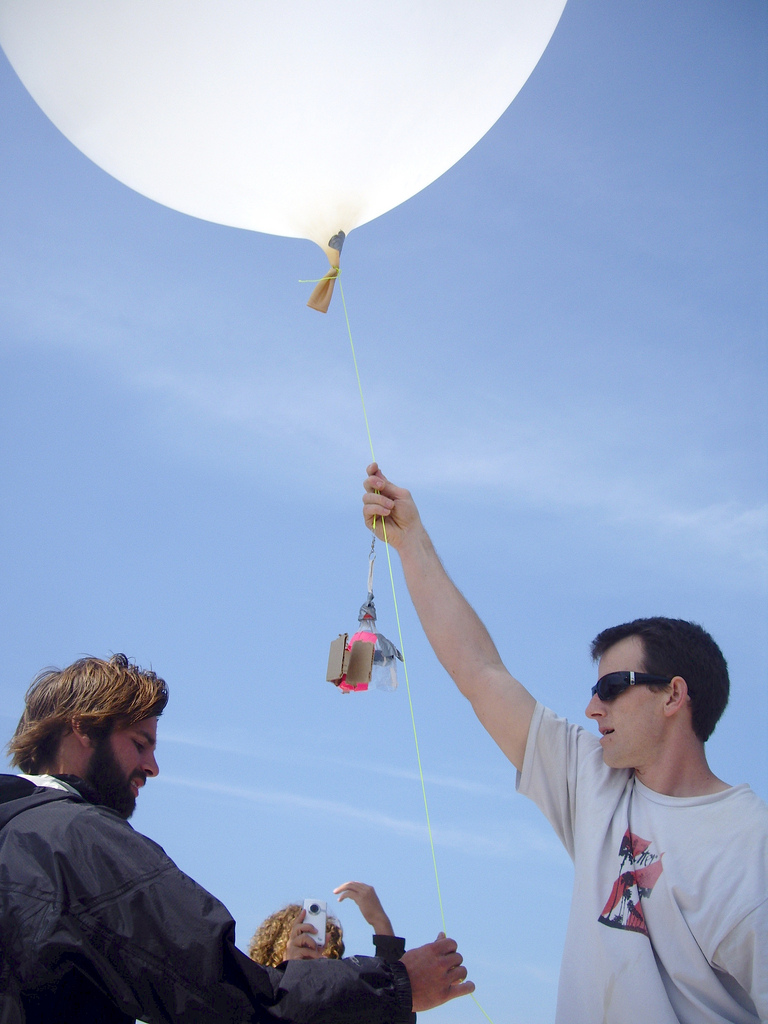
In April 2010, I met Jeff Warren and Stewart Long, two of the other co-founders of Public Laboratory for Open Technology and Science. The BP oil spill had just happened and in a mad dash effort, Jeff and Stewart had come to the Gulf Coast to help train residents and volunteers on using balloons and kites to map the oil spill, before, during and after it reached the Gulf Coast shoreline. Throughout the spill, they, and others, provided continuing remote support and the Gulf Coast team trained and organized the efforts of 100+ volunteers who collected over 100,000 images, resulting in over fifty maps of the region from during the time of the spill. With these images as a base, in spring 2011, Public Laboratory created the Public Laboratory Archive, modeled on the data.gov site. In summer 2011, Public Laboratory released the first Grassroots Mapping Forum of Wilkinson Bay, Louisiana. Since then, we’ve worked towards providing libraries in the Gulf Coast region with digital data sets of maps and images from the period of the oil spill and have been feeding images into Open Aerial Map.
Over the last year, Public Lab built out the Public Laboratory Archive online, figured out print and digital offline ways to get data back to communities, developed new DIY research tools and began collaborating with other open source projects. The Public Laboratory Archive includes the public domain data designation so the maps can be redistributed without friction. Such is the case with Google now licensing finished maps from our archive that have the public domain designation. We are excited that Google has connected with our archive, and hope that other organizations will choose to do the same. We hope to continue distributing our maps to Google several times a year. This first wave of maps includes 45 total maps and nine that are showing up in Google maps as well as Google Earth. More information about the release can be found on the Google Lat Long blog and you can also download the KML feed to view the maps in Google Earth.
For me, to have maps from the BP oil spill embedded in the historical layers of Google Earth, it means that static perspectives of the area will not perpetuate and that imagery of the polluted Louisiana coastline will be a searchable image on a mainstream geographic site. To have these maps accessible globally on Google honors the work of all community members by adding their perspective to official maps. We find especially exciting however, a map of the Gowanus Canal Superfund site in Brooklyn, New York that was created during the winter of 2011 and has been added to the primary layer of Google Earth/Google Maps. The New York chapter of Public Laboratory has begun an ongoing periodic monitoring campaign in partnership with local environmental advocacy group the Gowanus Canal Conservancy (GCC). Designated a Superfund cleanup site by the EPA in 2010 due to pollution from decades of coal tar accumulation in canal sediments, and suffering from 300 million gallons of untreated sewage which are released into the canal yearly, local activists have adapted and improved many of the techniques developed for monitoring the effects of oil contamination in the Gulf of Mexico. Community advocate, Eymund Diegel, notes, “Grassroots Mapping’s 2011 photo of the continued discharges shows how aerial balloon and kite photography provides visual evidence that could lead to better water quality enforcement.” That a group of local activists could create a high resolution map of an area they care about — and that such imagery could replace commercial and government data as a recognized representation of that place — is a powerful example of the civic science mission of Public Laboratory.